
Description
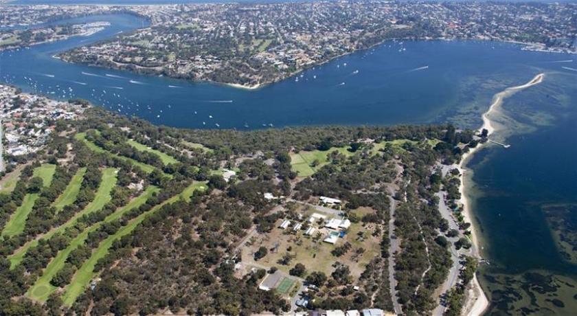
Point Walter is a point in the Swan River, Western Australia, notable for its large sandbar which extends into the river. It is located on the southern shore and forms the western end of Melville Water. Point Walter is located in the suburb of Bicton, approximately 12 kilometres south of the Perth Central Business District and 7 kilometres north-east of Fremantle, and is on the opposite side of the river to the suburbs of Mosman Park, Peppermint Grove, and Dalkeith.
Point Walter is a site of Aboriginal Australian heritage, both for its place in the Dreamtime and for the local Whadjuk people's historical activities at the site. Named in 1827 by Sir James Stirling, it was popular among the public for its use in a variety of recreational activities practised at the point, as well as its facilities such as tea rooms, a bathing house and a tavern. The point suffered a drop in patronage in a series of events from the late 19th century to World War II, where, in a state of disrepair, it was rehabilitated and an army camp was built on the premise, which later was transformed into a migrant settlement camp which closed in 1972. Since then the facilities have been used for multiple activities.
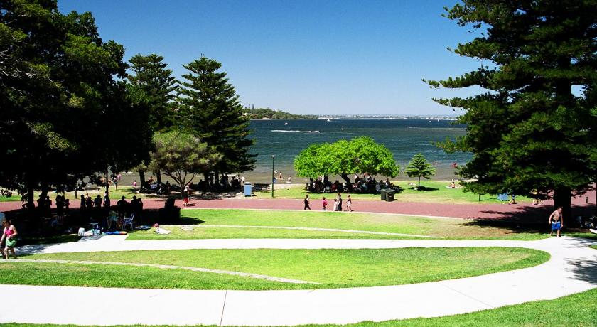
Since 1912 it has been run by the Melville City Council and today is contained in the Point Walter Reserve. The reserve and the sandbar serve as an important site for flora and fauna, particularly bird-life. It is popularly used for a variety of recreational activities, and currently hosts the annual Point Walter concert.
History
Indigenous history
Pre-settlement, the Point Walter area was inhabited by Indigenous Australians, specifically the Beeliar people, who were part of the Whadjuk Noongars. They knew Point Walter as Dyoondalup, meaning in the Noongar language "Place of Long Flowing White Hair" or "Place of white sand". It was a place traditionally for women and children, but when the clan wanted to move to another part of the river, the men would swim across the river to the sandbank, where they would meet the women. The sandbar was a key tool in getting from the Point Walter side of the river to the Mosman Park side, which was also a place traditionally for women. In Mosman Park, there was a rock which, when touched, was believed to make a woman pregnant within a few weeks. To cross from one side to the other, Aboriginals would chop down a tree and place their children on the log, which they floated across the river, swimming alongside it.
Aboriginals would often practise controlled burning at the site, which kept the understory low and also functioned as an effective tool for flushing out game. During summer months, the site was a source for a large variety of flora and fauna (the site was a prominent fishing spot, and fish traps were used extensively), which served as food and as resources. These resources include string made from the native wisteria (Hardenbergia comptoniana) and also gum from the marri (Corymbia calophylla).
Early history
Point Walter was named in honour of Sir James Stirling's brother, Walter Stirling, in 1827 during his survey of suitable spots for settlement along the Swan River. The land was then acquired by the settlers Lionel Lukin and Alfred Waylen. After acquiring the land, Waylen developed it by building a villa in 1830 which later burnt down, and in 1831 his land was extended 700 more acres to include part of the suburb to which he is the namesake, Alfred Cove. During his time at Point Walter Waylen constructed an inn known as "The Halfway House" due to its location between Perth and Fremantle, and a canal through the sandbar for ease of access for boats. Skirmishes with the local Beeliar people, such as Waylen's house being burnt down in 1833, and infertile soils saw these early settlers departing. By the 1850s, "The Halfway House" was being run by Samuel Caporn and his family, who, after arriving in Australia in 1842, settled on the Point Walter land. By the mid to late 1850s, the Caporns had moved to Perth due to the canal being silted up from large ferry usage.
At this time the land was a popular location for the general public for crabbing, camping, swimming and picnicking. The only way to access the point was by boat, so a jetty was subsequently built. Point Walter was then very popular, and to deal with ferries and yachting parties two tea rooms and a timber bathing house were constructed. Later a limestone road was constructed allowing access by horse-drawn carriages. In 1907 the State Government purchased the land, declaring it a Class A reserve, and several years later in 1912 the Melville Roads Board (currently known as the Melville City Council) was appointed to manage it. The reserve's official opening occurred on 30 November 1914.
Decline
After the introduction of the Fremantle-Perth railway on 1 March 1881, Point Walter suffered a drop in patronage, becoming a "quiet backwater". Steamers going along the Swan River stopped using the sandbar's narrow and shallow channel, instead travelling the full way around the sandbar, causing a drop in popularity for the tea rooms. The reason for this stop in travelling around is because by the mid-1850s the canal had fallen into a state of disrepair because the local authorities had not kept up work maintaining it after the Caporn family left the area. A campaign by businessman George Randell, then controller of river traffic, attempted to reopen the canal, but due to the cost of £2000 it was not completed.
In January 1923 to secure funding for the Point Walter memorial avenue, a three day carnival was held at Point Walter. By this time, in 1923, the Melville Roads Board was receiving £100 a year for grounds maintenance, which was proving inadequate for keeping the grounds in order. A further decline in use came due to increased use of ocean beaches by the public, and as a result, control was passed in 1929 to the Parks and Gardens Board. By 1915, a tramway had been constructed between Canning Road and Point Walter, which was not considered a success as it rarely ran at a profit except during summer months, and closed down soon after the 1950s. Further troubles came from the Depression of the 1930s in which another drop in recreational use was experienced. After yet another drop in recreational use due to World War II, Point Walter fell into a state of disrepair. During that period of WWII, in 1941 the Melville Army Camp was constructed on the land and used for training soldiers for waterborne warfare.
Post World War II to modern day
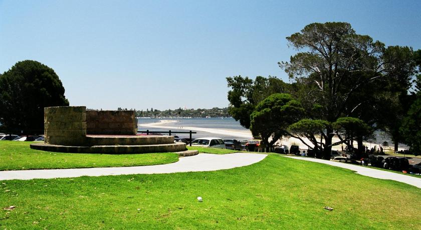
The state of disrepair continued until the reserve was again put in the hands of the Melville Roads Board, which made several alterations to the site, including all old buildings being removed, the river beach being restored, and new changing rooms, toilet facilities and a kiosk being built. In 1947, the army camp was converted to a Migrant Reception Centre, which was operated from 1947-1969 by the state government and from 1969 until closure in mid-1971 by the Commonwealth Hostels. During the time when the Migrant Reception Centre was open, public opinion of the migrants was that the majority were communists, to the point where in 1950 the matter had to be addressed in The West Australian. Post 1972 the facilities were used by the Department of Education to house the Graylands Teachers College. Control of 6.5 hectares of the land that had been used for army training purposes were handed over to the Department of Sport and Recreation in 1980, which in 1986 removed all remaining hostel buildings and spent a considerable sum developing land to the sport and recreational facilities seen today, with the official reopening occurring on 26 September 1986. The facilities' first patrons were the members of the Costa Smeralda Yacht Club - the Italian syndicate that participated in the Fremantle-hosted 1987 America's Cup. In 2005 the facilities were once again refurbished with funding from the DRS Capital Works Program. Today, all that remains of the army camp is a watch-house from 1941. Point Walter is currently managed by the Melville Council.
Sandbar
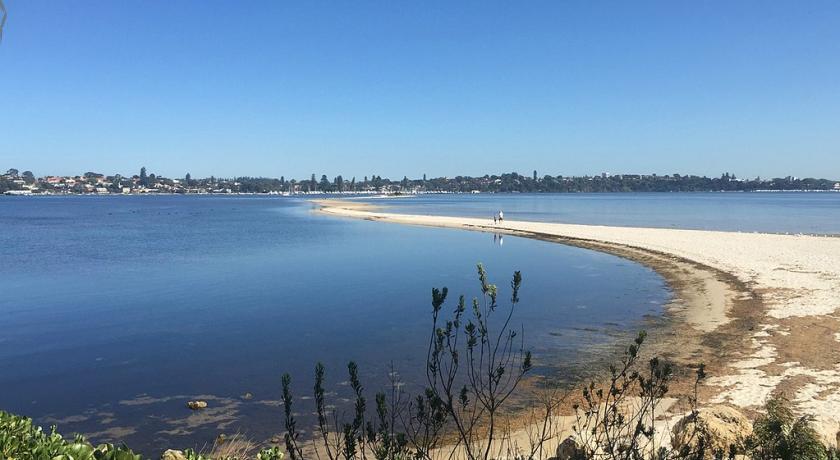
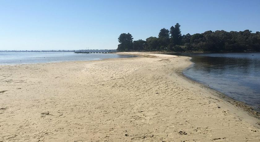
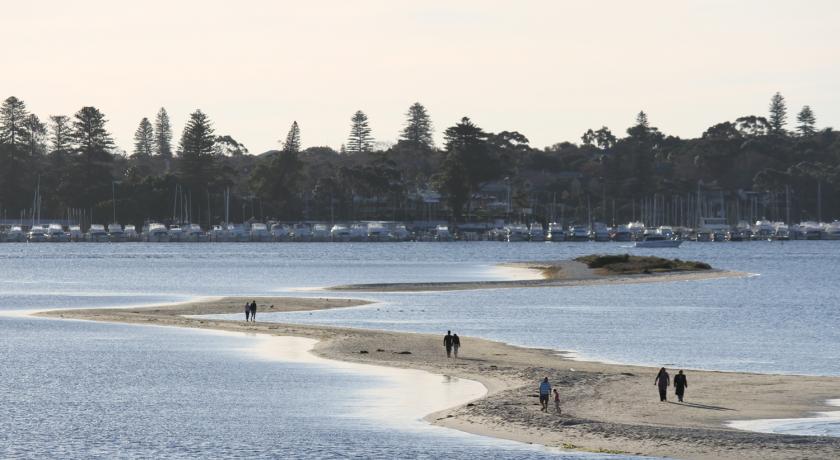
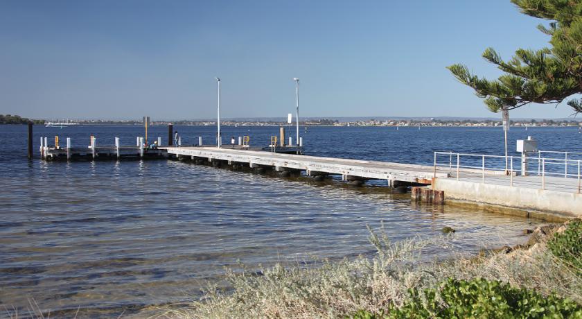
Point Walter is notable for the sandbar or spit that extends over 1 km into the river, sections of which are often submerged under high water.
Dreamtime relevance
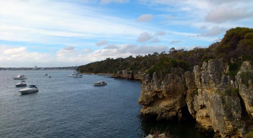
The sandbar is prevalent in the Dreamtime of the local Aboriginals. Local Aboriginals believed the sandbar was the hair of the Dreamtime figure Djunda (alternatively spelt Junda), the Charnok woman, and the nearby cliffs at Blackwall Reach were her footprints. Junda is said to have carried spirit children in her hair, who, when they fell out, formed rocks. According to Dreamtime stories, when she reached Wave Rock, she jumped off it into the sky, at which point her hair formed the Milky Way and the spirit children formed the stars. Due to this, Blackwall Reach is known to the Aboriginals as Jenalup, a word meaning "The Place Where Feet Make a Track".
Bird life
The sandbar is the nesting grounds of several bird species. They include the pied oystercatcher, the red-capped plover, the black swan and the fairy tern. The local government has made a conservation effort with the campaign "Don't Buzz That Bird", telling people not to get too close to them.
Geography
Point Walter is contained within the Point Walter Reserve, which mainly consists of the Point Walter bushland. This consists primarily of three habitats:
- A limestone ridge that outcrops on the lower slopes
- Deep yellow sand over the ridge
- Woodland higher up consisting of jarrah and marri
Flora and fauna
Within the Point Walter bushland, different habitats contain different populations of flora. The deep yellow sand supports the rare acorn banksia (Banksia prionotes) and tree smokebush (Conospermum triplinervium) species. In areas of the higher up jarrah and marri woodland which are less disturbed, there are several orchid species, including a group of rare albino fairy orchids Caladenia latifolia as well as several red spider orchid Caladenia areicola populations.
In terms of botanical history the Point Walter bushland is significant as it was at this location early botanists first collected Couch Honeypot (Dryandra lindleyana) and cottonheads (Conostylis candicans). It is also possible that here they also collected a tall Dryandra, a form of Parrot Bush D. sessilis which is presently unnamed. In 1839 the Cryptandra glabrata was collected at Point Walter, which has not been seen since here and is considered at possibly extinct at Point Walter.
In the Point Walter bushland hollows are used for nesting by galahs and Port Lincoln parrots. Carnaby's black cockatoos feed on parrot bush in the area. The area is also home to native species of frogs, small reptiles and various insects. There are also various pest animals present in the area, such as rabbits, cats, dogs and fox.
Erosion
In February 2012 Natural Area Management was contracted by the City of Melville to undergo reversal of erosion that had occurred over the last 10 years due to losses of beaches and grassed areas, factors aided by the undercutting of tree roots. With works beginning in March 2012, initial works were finished in 2013; the project was completed as a whole in early 2014.
Public use
Point Walter is the site of various cultural monuments and activities, including a war memorial avenue and the free annual Point Walter concert, which started in 1996 and features Perth bands, and on occasion notable individuals such as James Morrison. Previously this event was called "YAC it up" due to it being organised by Melville's Youth Advisory Council and featured acts such as Birds of Tokyo and Bob Evans.
Point Walter is utilised by the general public for a variety of activities, including kitesurfing, kayaking, canoeing, windsurfing, fishing, passive recreation, swimming, diving courses and picnicking. The area contains various facilities for the general public such as playgrounds, cycle paths, a jetty, and barbecues. Point Walter also contains Walters River Café. Point Walter is contained in the Point Walter Reserve, which contains the Point Walter Golf Course, and Blackwall Reach.
Source: https://en.wikipedia.org/wiki/Point_Walter
Address
Perth
Australië
Lat: -32.013740540 - Lng: 115.788459778

